Regional Patterns of Air Quality (RePAQ)
- Contact:
Roland Stirnberg
Jan Cermak - Funding:
Graduate School for Climate and Environment (GRACE)
- Start Date:
2017
- End Date:
2020
Project Overview
The project aims to evaluate temporal and spatial patterns of urban air quality and its geophysical determinants. Remote sensing, using both satellite-based and ground-based instrumentation, will be employed to understand how satellite-retrieved atmospheric aerosol loading can be used to approximate street-level air pollution. The former is represented by satellite derived spatial averages of the aerosol optical depth (AOD), while the latter represents point measurements of ground particulate matter (PM) concentrations. Links between these two variables will be evaluated with respect to other parameters such as the mixing-layer height, humidity, wind and land surface temperature.
Project Highlights
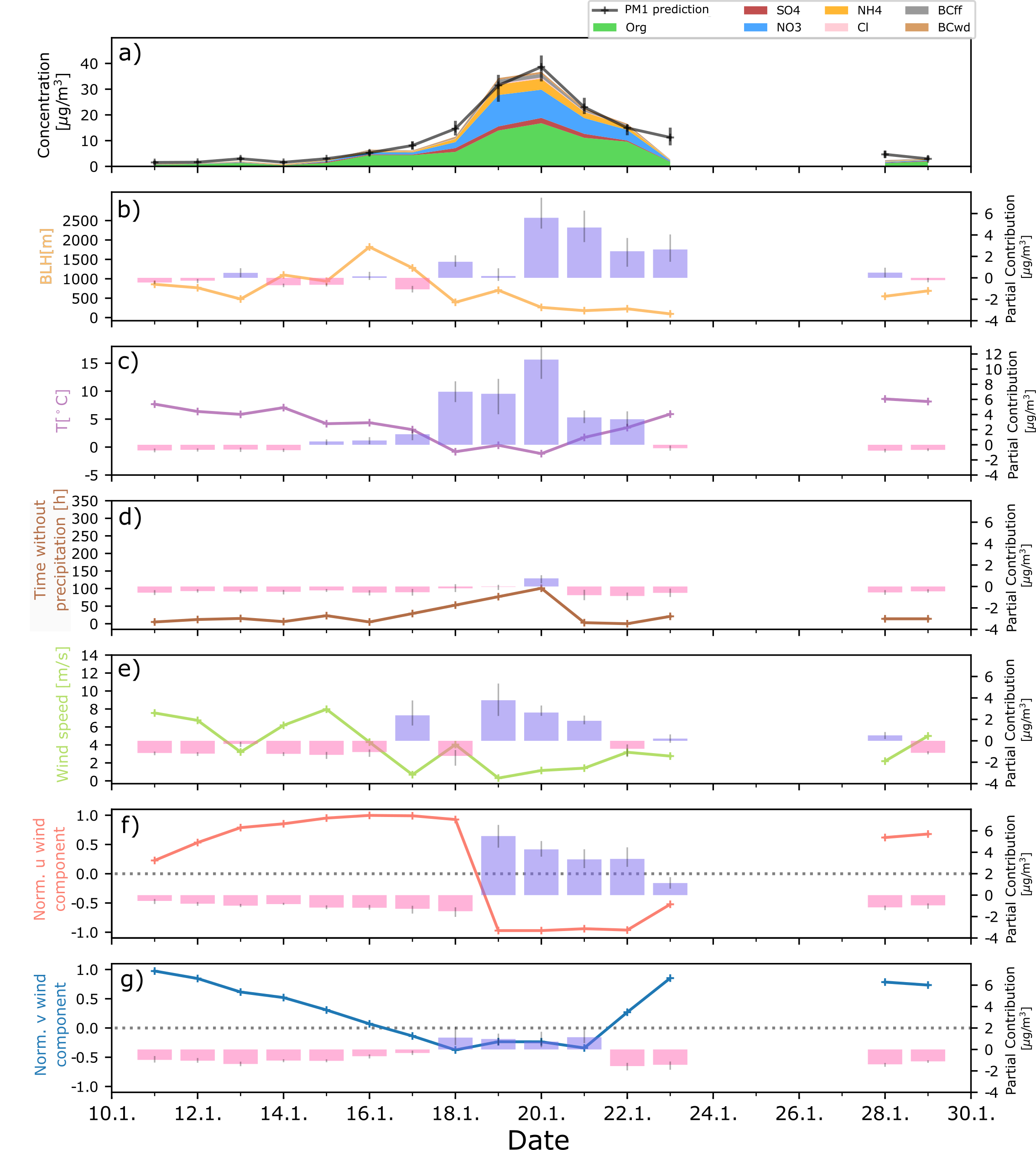
- In this study [link to] we use an explainable machine learning approach to analyse periods of high particle concentrations for a suburban site southwest of Paris to better understand its atmospheric drivers. Air pollution is particularly excaberated by low temperatures and low mixed layer heights, but processes vary substantially between and within seasons. In the figure below, we show how machine learning allows us to quantify influences on air pollution. Here, this is shown for a short but intense episode of high concentrations of PM1 (particles with a diameter <1µm). In the upper panel, the PM1 concentration and the model prediction is shown. In panels b)-g), atmospheric parameters are shown as absolute values on the left y-axis and their partial contribution to the model prediction is shown on the right y-axis.

- In two other publications, we explored the factors influencing the relationship between satellite-derived aerosol optical depth and ground-level PM10 (Stirnberg et al. 2018 [link to]), and quantify the drivers of air quality using satellite data and machine learning (Stirnberg et al. 2020 [link to])
